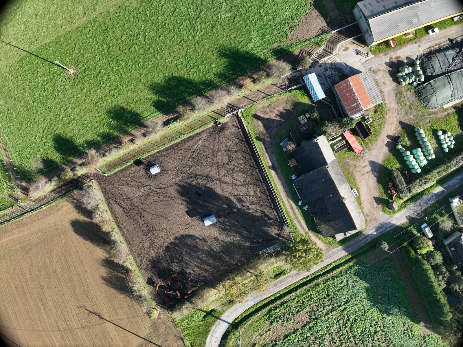
The starting pointA field, as the camera saw it.Actual prototype input · November 7, 2023
01 / WHY HERDPROOF
A count is more useful when you can inspect the evidence.
I built HerdProof to explore whether drone imagery could give agricultural lenders more context during remote livestock reviews. The question is simple: what was observed, where is the evidence incomplete, and what should a reviewer check next?
The industrialization opportunity is a repeatable inspection workflow: capture, review, and export a record that can be checked again. Its value for lenders still needs to be measured in a real pilot.
02 / THE APPROACH
From a flight to a review.
Keep the original evidence close. Keep uncertainty visible.
01
Capture the field
Bring in survey photos, their capture metadata, and the field boundary.
Photos + field context
02
Find the cattle
A cattle detector proposes observations across full-resolution image tiles.
Traceable observations
03
Connect the views
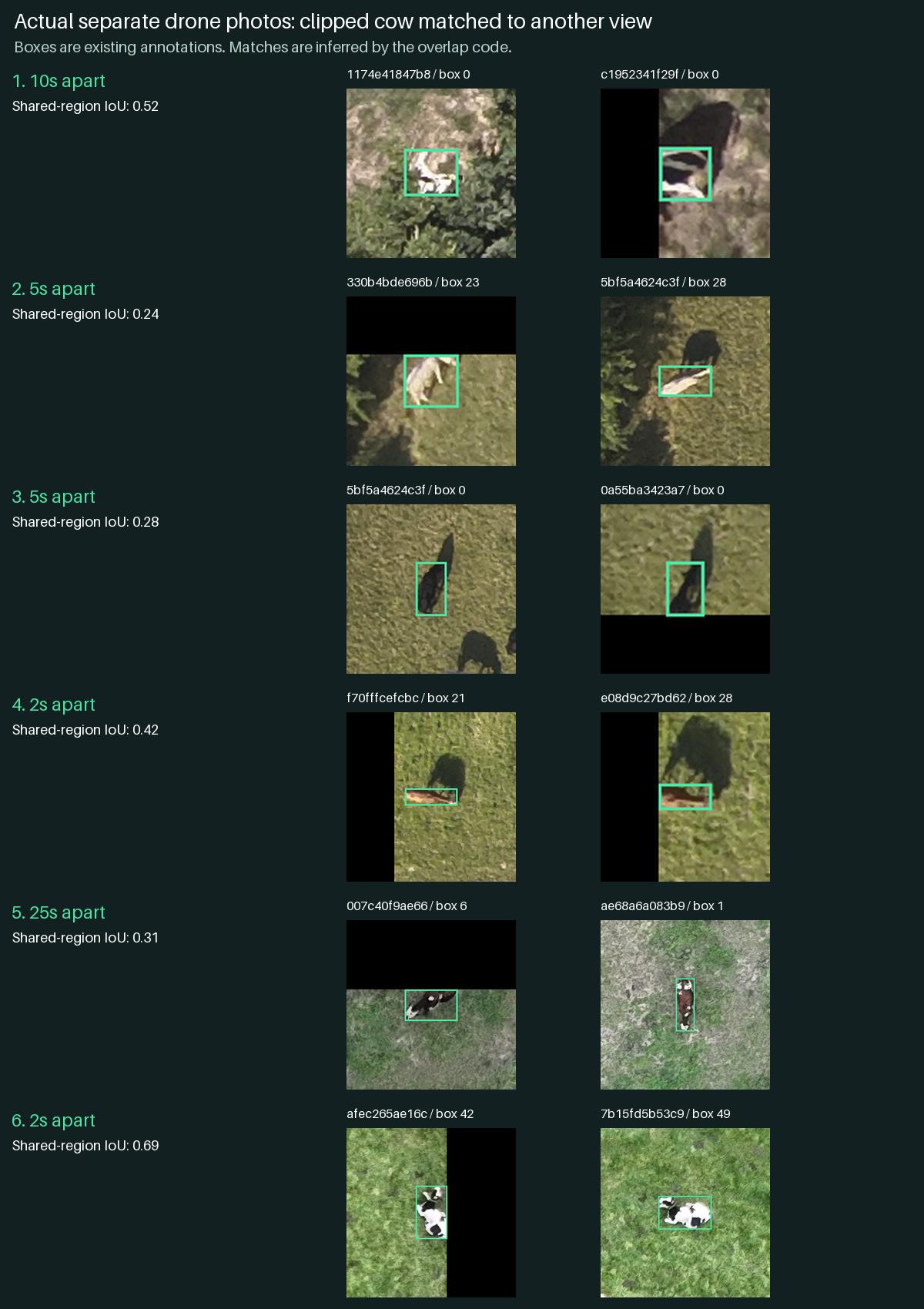
Align overlapping photos and merge repeated sightings, including clipped views.
Estimated distinct sightings
04
Review what remains
Inspect uncertain observations, check photo consistency, and export an assessment.
A record + a next action
Where the walkable scene fits: it adds field context, using measured elevation with approximate photo alignment and cow appearance. It is a visualization, not an independently verified digital twin. Walk the surveyed field ↗
03 / A CONCRETE REVIEW
“Do we have enough evidence to move this review forward?”
Imagine a loan officer reviewing a livestock survey. HerdProof's role is to organize the observations and bring unresolved evidence to the surface.
The lending scenario is illustrative. The figures alongside it come from an actual two-photo run of the prototype, completed September 6, 2026.
estimated distinct cattle sightingsUnreviewed model output
Capture date
Nov 7, 2023
Photos processed
2
Raw observations
30
Repeated sightings removed
12
Unresolved clipped sighting
1
Whole-property coverage
Not verified
↳
Next actionReview the proposed sightings and obtain a clearer view of the unresolved edge capture before relying on the count.
18 is an estimate of distinct observed animals. It is not a verified herd inventory, ownership check, or loan recommendation.
04 / THE ENGINEERING
Show the work. Name the limits.
Two different tests answer two different questions.
CATTLE DETECTION
Can the model find visible cattle?
81.92%Precision
77.91%Recall
Corrected YOLOv8n v2, evaluated on 77 images at a 0.70 confidence cutoff.
What these figures mean
Provisional agreement with 1,041 source annotations. Some labels omit visible cows, and this benchmark had already been inspected. These are exploratory diagnostic results; independent validation is still needed.
192 / 192controlled crop cases passed 1,293 known duplicate links
The fix compares observations only inside their shared visible area, so a clipped cow can match a fuller view. Unresolved edges remain flagged for recapture.
These tests use supplied annotation boxes. They assess overlap handling, separately from detector accuracy and whole-herd validation.
The prototype does not establish animal ownership, authenticated capture, complete property coverage, loan eligibility, or lender acceptance. No human time-saving claim has been established.
05 / SEE THE MODEL
Every box below came out of the model.
Saved output from the shipped detector. Then the same detector, in your browser.
Everything above this point is a number I am asking you to take on trust. Here the detector's actual output is on the photograph, at whatever confidence you choose.
Loading saved detections…
NOW WITHOUT THE SAFETY NET
Run the model on your own photo.
The same 12 MB checkpoint, downloaded into this page and executed on your hardware. Nothing is uploaded, and there is no backend to fall back on — if it does badly, you will see it do badly.
Your photo is read in this tab and never uploaded. There is no server behind this — the model runs on your machine.
Expect it to do badly on most photos. This model was fine-tuned on nadir drone imagery of grazing cattle at survey altitude. A ground-level photo, a different animal, or a different camera angle is outside everything it was trained on, and the result you get will say more about that gap than about the model's measured accuracy.
The same detections, placed on the measured terrain: walk the surveyed field ↗— view only; corrections are made in the local tool.
06 / FROM PROTOTYPE TO PRACTICE
Start with one lender. One ranch. A real review.
A proposed pilot, with success defined before the first flight.
WHO USES IT
The livestock reviewer.
An agricultural loan officer or collateral reviewer, working with a ranch and its existing inspection process.
HOW IT FITS
Evidence in. Record out.
Capture agreed survey areas, review the observations, and export an assessment into the lender's current workflow. A person remains responsible for the decision.
WHAT TO MEASURE
Useful, after correction?
Compare independently checked counts, correction time, missed cattle, recapture frequency, and total review time. Track capture and processing costs.
Before deployment
Independently checked reference data · Secure access to farm imagery · Agreed capture protocol · Measured operating costs